Skip to content
Map of Blue Hole
Add the first photo
AdvancedBoat entry

Blue Hole

Guam, United States
AOW suggested15–40 m (50–131 ft) depthBoat entryRash guard or 2mm shorty typical

Boat dive — see Entry & access.

Blue Hole at a glance

Blue Hole is an advanced boat dive site in Guam, United States with depths of 15.2–40 m (50–131 ft). Typically most favorable Jun · from 3 years of archive data. Divers commonly see Octopus, Anemonefish, and Moray eel. Recent reports put the water around 29°C (84°F). Check the latest conditions and entry details before you go.

Next window today· 16:00–18:00 · moderate · sunset 17:56

Forecast for this hour · 15:00 · run under 1 h ago
1.1 m (3.6 ft)waves — about a meter expected (waves — about four feet expected)

Tap a factor for its source and model point · Forecast 29°C · seasonal avg 30°C ( · Forecast 84°F · seasonal avg 86°F)

Site hazards: Deep shaft, easy accidental over-depth, narcosis, strong current/drift exposure, brief overhead/cavern-like route, wall drop-off beyond recreational limits, boat pickup, and military/restricted shoreline nearby.

Read the full hazards ↓

Dive windows this week

Smallest waves: Wed
Mon16:00–18:00 moderate

1.1 m waves · 12 kn wind (3.7 ft waves · 12 kn wind)

Tue7:00–18:00 favorable

1.0 m waves · 4 kn wind (3.3 ft waves · 4 kn wind)

Wed7:00–18:00 favorable

0.8 m waves · 4 kn wind (2.7 ft waves · 4 kn wind)

Thu7:00–9:00 favorable, 9:00–14:00 moderate, 14:00–15:00 favorable, 15:00–17:00 moderate, 17:00–18:00 favorable

0.9 m waves · 8 kn wind (2.8 ft waves · 8 kn wind)

Fri7:00–10:00 favorable, 10:00–18:00 moderate

1.3 m waves · 10 kn wind (4.1 ft waves · 10 kn wind)

Sat7:00–18:00 moderate

2.0 m waves · 9 kn wind (6.5 ft waves · 9 kn wind)

Sun7:00–14:00 favorable, 14:00–18:00 moderate

1.8 m waves · 4 kn wind (5.8 ft waves · 4 kn wind)

Favorable windowModerate window— no window

Every forecast dive window each day, site-local time, from wave and wind forecasts. Numbers under each bar are daylight averages.

First light 5:52 · Sunrise 6:13 · Sunset 17:56 · some windows run past sunset

Source: Open-Meteo marine · model point 6.8 km from site · updated 26 Oct, 15:22 GMT+10

Forecast only — always assess conditions on site.

Compare this weekend’s windows near Blue Hole

Forecast · NOAA tide model

Tide & slack timing

Loading tide predictions

Recent diver reports

Dated firsthand observations from divers — not current conditions.

No diver reports for this site yet. — one dated observation helps every diver after you.

Dived here today — did the forecast match?

What Divers Say

Best time: Use a calm-weather, low-current window selected by local operators; avoid strong afternoon/current conditions.

Based on community reviews and site data. Conditions vary — always verify before diving.

Best months, historically

What conditions have historically been typical at this site, month by month — not a forecast.

  1. January, 11% of days have historically been favorable, water has typically been 29°C (84°F), waves have typically been 2.2 m (7.3 ft), wind has typically been 19 knots
  2. February, 1% of days have historically been favorable, water has typically been 28°C (83°F), waves have typically been 2.2 m (7.3 ft), wind has typically been 20 knots
  3. March, 32% of days have historically been favorable, water has typically been 28°C (83°F), waves have typically been 1.9 m (6.1 ft), wind has typically been 17 knots
  4. April, 54% of days have historically been favorable, water has typically been 29°C (83°F), waves have typically been 1.5 m (4.9 ft), wind has typically been 16 knots
  5. May, 73% of days have historically been favorable, water has typically been 29°C (84°F), waves have typically been 1.5 m (4.8 ft), wind has typically been 16 knots
  6. June, 87% of days have historically been favorable, water has typically been 30°C (85°F), waves have typically been 1.1 m (3.6 ft), wind has typically been 14 knots, historically most favorable
  7. July, 78% of days have historically been favorable, water has typically been 30°C (86°F), waves have typically been 1.3 m (4.2 ft), wind has typically been 15 knots
  8. August, 71% of days have historically been favorable, water has typically been 30°C (86°F), waves have typically been 1.3 m (4.2 ft), wind has typically been 13 knots
  9. September, 73% of days have historically been favorable, water has typically been 30°C (86°F), waves have typically been 1.4 m (4.5 ft), wind has typically been 15 knots
  10. October, 55% of days have historically been favorable, water has typically been 30°C (86°F), waves have typically been 1.6 m (5.2 ft), wind has typically been 15 knots
  11. November, 22% of days have historically been favorable, water has typically been 29°C (85°F), waves have typically been 1.8 m (5.8 ft), wind has typically been 18 knots
  12. December, 10% of days have historically been favorable, water has typically been 29°C (84°F), waves have typically been 2.0 m (6.5 ft), wind has typically been 18 knots

June has typically had the largest share of favorable days here. Conditions vary year to year — this is historical context, not a forecast.

Based on 3 years of archive data. Bar height shows the share of days each month whose conditions have historically scored favorably.

Marine life recorded at this site, by month

Recorded observations — evidence of past sightings, not a promise of what you’ll encounter.

Species seen here

Rough labels: “Commonly seen” usually means two or more recorded sightings near this site in public dive logs (GBIF), “Occasionally seen” one; “Seasonal” and “Rarely seen” come from dive-guide research. Not a measured rate.

  • Blacktip Shark recorded here Apr (1 record)

    Carcharhinus limbatusmost recent 2012

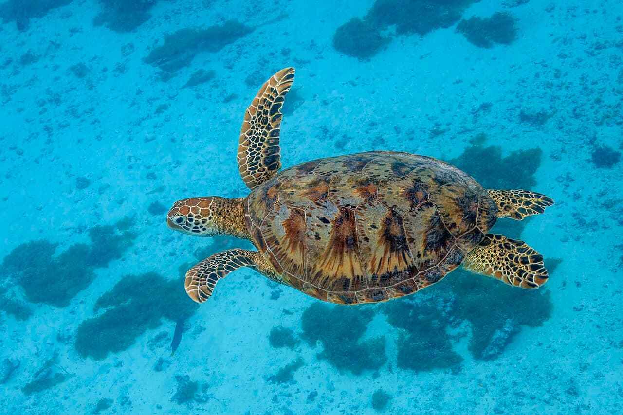
  • Green Turtle recorded here Apr (1 record)

    Chelonia mydasmost recent 2012

  • Sea eagle recorded here May (1 record)

    Myliobatis aquilamost recent 2013

  • Whitetip Reef Shark recorded here May (1 record)

    Triaenodon obesusmost recent 2013

  • Yellow Edged Moray recorded here Apr (1 record)

    Gymnothorax flavimarginatusmost recent 2012

Newest record here: 2013. Counts are occurrence records near this site from public biodiversity datasets (GBIF), grouped by calendar month across all sampled years. Sightings vary — past records are context, not a prediction.

The underwater calendar

When these animals are most recorded around Micronesia & western Pacific — from open sighting data, not a promise.

Watch the whole year animate on the Migrations map

Fills & rentals nearby

Facts from OpenStreetMap, corrected by the community — listed by distance only. Details change; confirm with the shop.

Shop facts come from OpenStreetMap and community corrections, shown nearest first. PickADive lists facts and contacts only — no listing is sponsored or ranked.

Data updated July 2026

Site details

Natural shaft/sinkhole off Orote Point, normally dived from a boat. Divers enter the opening on the reef top, descend through the blue-water shaft, and exit onto the outside wall near the recreational depth limit. The bottom continues far beyond recreational limits, so depth control is the central planning issue.

boatcavewall

Deep shaft, easy accidental over-depth, narcosis, strong current/drift exposure, brief overhead/cavern-like route, wall drop-off beyond recreational limits, boat pickup, and military/restricted shoreline nearby.


Reviews

No reviews yet — this site is waiting for its first. Dived here? Your rating and a few lines help the next diver.


Spot something off?

Help keep this listing accurate for the next diver.