Skip to content
Map of Cartanser Sr Wreck
Add the first photo
Boat entry

Cartanser Sr Wreck

U.S. Virgin Islands, United States
Open Water suggested6–18 m depthBoat entryRash guard or 2mm shorty typical

Boat dive — see Entry & access.

Cartanser Sr Wreck at a glance

Cartanser Sr Wreck is a boat dive site in U.S. Virgin Islands, United States with depths of 6–18 m (20–59 ft). Typically most favorable May · from 3 years of archive data. Divers commonly see moray eels, reef sharks, and sergeant major. Recent reports put the water around 29°C (84°F). Check the latest conditions and entry details before you go.

Marine model · graded 10h ago
1.0 mwaves — about a meter expected

Tap a factor for its source and model point · Forecast 29°C · seasonal avg 29°C

Site hazards: Boat traffic, scattered metal wreckage, hurricanes/storm damage, possible current, coral contact, and limited shore access.

Read the full hazards ↓

Dive windows this week

Best: Mon
Mon6:00–19:00
Tue6:00–19:00
Wed6:00–19:00
Thu6:00–19:00
Fri6:00–19:00
Sat6:00–19:00
Sun6:00–19:00

Favorable windowModerate window— no window

First light 5:32 · Sunrise 5:56 · Sunset 18:56

Source: Open-Meteo marine · model point 6.8 km from site · graded 10h ago

Forecast only — always assess conditions on site.

Forecast · NOAA tide model

Tide & slack timing

Loading tide predictions

Recent diver reports

Dated firsthand observations from divers — not current conditions.

No diver reports for this site yet. — one dated observation helps every diver after you.

What Divers Say

Best time: Generally year-round in settled Caribbean conditions; avoid storms and post-hurricane poor visibility.

Based on community reviews and site data. Conditions vary — always verify before diving.

Best months, historically

What conditions have historically been typical at this site, month by month — not a forecast.

  1. Jan27%27°C1.8 m
  2. Feb20%27°C1.9 m
  3. Mar33%27°C1.8 m
  4. Apr52%27°C1.6 m
  5. May80%28°C1.2 m
  6. Jun67%29°C1.3 m
  7. Jul54%29°C1.4 m
  8. Aug56%29°C1.4 m
  9. Sep68%30°C1.4 m
  10. Oct54%30°C1.6 m
  11. Nov34%29°C1.7 m
  12. Dec26%28°C1.9 m

May hastypically had the largest share of favorable days here. Conditions vary year to year — this is historical context, not a forecast.

Based on 3 years of archive data. Bar height shows the share of days each month whose conditions have historically scored favorably.

Marine life seen at this site

Species noted at this site — not a promise of what you’ll encounter.

Species seen here

  • moray eelsOccasionally seen
  • reef sharksOccasionally seen
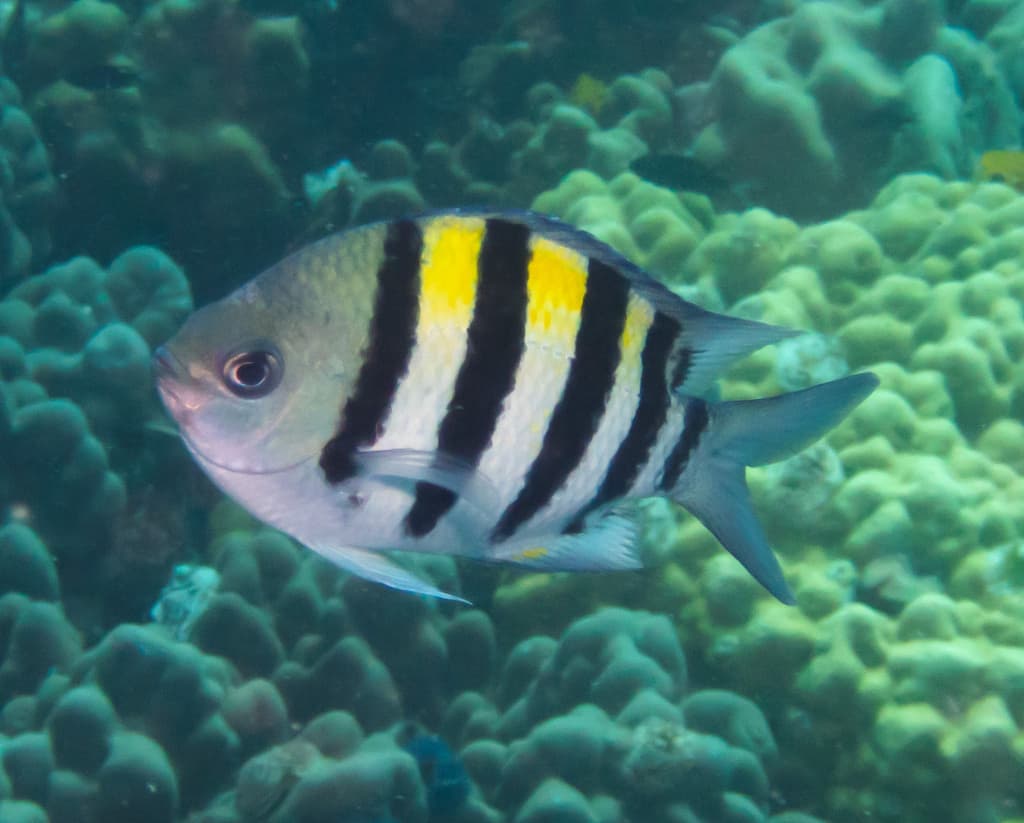
  • sergeant majorCommonly seen
  • turtlesOccasionally seen
  • yellowhead jawfishOccasionally seen

Fills & rentals nearby

Facts from OpenStreetMap, corrected by the community — listed by distance only. Details change; confirm with the shop.

Shop facts come from OpenStreetMap and community corrections, shown nearest first. PickADive lists facts and contacts only — no listing is sponsored or ranked.

Site details

Broken-up WWII-era freighter/artificial-reef style wreck near Buck Island, St. Thomas. The wreck lies in several sections with visible engines, coral/sponge growth, and fish life, making it a novice-to-intermediate boat wreck in good conditions. No penetration should be expected because the wreck is fragmented.

boatreefwreck

Boat traffic, scattered metal wreckage, hurricanes/storm damage, possible current, coral contact, and limited shore access.


Reviews

No reviews yet — this site is waiting for its first. Dived here? Your rating and a few lines help the next diver.


Spot something off?

Help keep this listing accurate for the next diver.