Skip to content
Map of Seacrest cove 2
Add the first photo
IntermediateShore entry

Seacrest cove 2

Washington, United StatesDirections
Open Water suggestedCold Puget Sound water year-round (45-55 F). Boat traffic3–27 m depthShore entry

Seacrest cove 2 at a glance

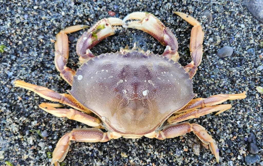
Seacrest cove 2 is an intermediate shore dive site in Washington, United States with depths of 3–27.4 m (10–90 ft). Typically most favorable Mar–Sep · from 3 years of archive data. Divers commonly see Sculpins (various), Rockfish (copper/quillback), and Red rock and Dungeness crab. Check the latest conditions and entry details before you go.

Marine model · graded 13h ago
0.0 mwaves — under half a meter expected

Tap a factor for its source and model point

Site hazards: Cold Puget Sound water year-round (45-55 F). Boat traffic

Read the full hazards ↓

Dive windows this week

No dive windows in this week’s forecast — no stretch of daylight hours scored favorable or moderate for this site.

First light 6:10 · Sunrise 6:42 · Sunset 19:29

Source: Open-Meteo marine · model point 13 km from site · graded 13h ago

Forecast only — always assess conditions on site.

Forecast · NOAA tide model

Tide & slack timing

Loading tide predictions

Recent diver reports

Dated firsthand observations from divers — not current conditions.

No diver reports for this site yet. — one dated observation helps every diver after you.

Dived here today — did the forecast match?

What Divers Say

Known for: Sculpins (various), Rockfish (copper/quillback), Red rock and Dungeness crab
Best time: Diveable year-round at almost any tide thanks to minimal current; winter offers the best visibility. Avoid water-taxi rush periods and busy summer weekends for easier parking.

Based on community reviews and site data. Conditions vary — always verify before diving.

Best months, historically

What conditions have historically been typical at this site, month by month — not a forecast.

  1. Jan99% 0.1 m
  2. Feb99% 0.2 m
  3. Mar100% 0.2 m
  4. Apr100% 0.2 m
  5. May100% 0.1 m
  6. Jun100% 0.1 m
  7. Jul100% 0.1 m
  8. Aug100% 0.1 m
  9. Sep100% 0.1 m
  10. Oct99% 0.2 m
  11. Nov99% 0.2 m
  12. Dec97% 0.2 m

March, April, May, June, July, August, and September havetypically had the largest share of favorable days here. Conditions vary year to year — this is historical context, not a forecast.

Based on 3 years of archive data. Bar height shows the share of days each month whose conditions have historically scored favorably.

Marine life recorded at this site, by month

Recorded observations — evidence of past sightings, not a promise of what you’ll encounter.

  • Calappidae recorded here Feb (1 record)

    most recent 2012

  • Nudibranchia recorded here Feb (1 record)

    most recent 2012

  • Polyorchis penicillatus recorded here Jul (1 record)

    most recent 2013

Counts are occurrence records near this site from public biodiversity datasets (GBIF), grouped by calendar month across all sampled years. Sightings vary — past records are context, not a prediction.

Fills & rentals nearby

Facts from OpenStreetMap, corrected by the community — listed by distance only. Details change; confirm with the shop.

Shop facts come from OpenStreetMap and community corrections, shown nearest first. PickADive lists facts and contacts only — no listing is sponsored or ranked.

Data updated June 2026

Site details

Seacrest Cove 2 ('Alki Cove 2') at Seacrest Park in West Seattle is one of the most-dived sites in Washington and the unofficial heart of Seattle's dive community. A gradual rocky slope descends past artificial structures - the famous Honey Bear wreck around 35 ft, I-beams, small boat wrecks and junk piles - that shelter the site's headline residents: giant Pacific octopuses. The cove lies within the WDFW Alki Beach Seacrest Coves 1, 2 and 3 octopus-harvest preserve, created after a controversial 2012 octopus take here. Easy stair-and-beach entry, minimal current, free street parking and city skyline views make it ideal for training and night dives, but it is genuinely cold - drysuits are the norm.

muckshorewreck

Cold Puget Sound water year-round (45-55 F). Boat trafficKing County Water Taxi dock and a marked no-dive boat lane (yellow/orange buoys) at the site - stay out of the lane and the Elliott Bay ferry lanes. Slope continues well past 90 ft into deep, dark water - monitor depth. Variable visibility (often 5-15 ft, worse in summer plankton blooms). Entanglement around artificial structures and occasional fishing line. Currents are minimal but navigational confidence is required.


Reviews

No reviews yet — this site is waiting for its first. Dived here? Your rating and a few lines help the next diver.


Spot something off?

Help keep this listing accurate for the next diver.